Hiking Journal
July 2015
bear creek loop
I hiked up the logging road that leads to a trailhead on the Sisson-Callahan Trail and shortly after I started up the trail I surprised a bear who was also "hiking" on the trail, and he took off down into the meadow, leaving me with the trail all to myself. This is a quick way to get up to the ridgetop, where it meets the Pacific Crest Trail, and continues down into the headwaters of the North Fork of the Sacramento River.
I headed out the PCT toward Toad Lake, where, on the map anyway, a trail led from the lake up to the PCT and then up to the crest, where it went down into the headwaters of Bear Creek and met up with the Sisson-Callahan Trail. This "trail" would have given Daniel Boone fits — it soon became a lesson in routefinding that I actually enjoyed. In some places my GPS showed me standing on the trail, but there was absolutely nothing to see on the ground that would distinguish it from any other place nearby, but pressing on I could see hints here and there where a trail might have been, and after reaching the crest and dropping down the other side it became more evident that I was indeed following what, at one time, must have been a trail.
Along the western slope there were several swampy spots that were covered with meadow grass and lots of wildflowers, and farther down I came upon what could be called a "pond", and even farther along there was a small "lake". Lots of bear sign around but I didn't see any more bears, just one deer and lots of small chipmunks.
mt. eddy
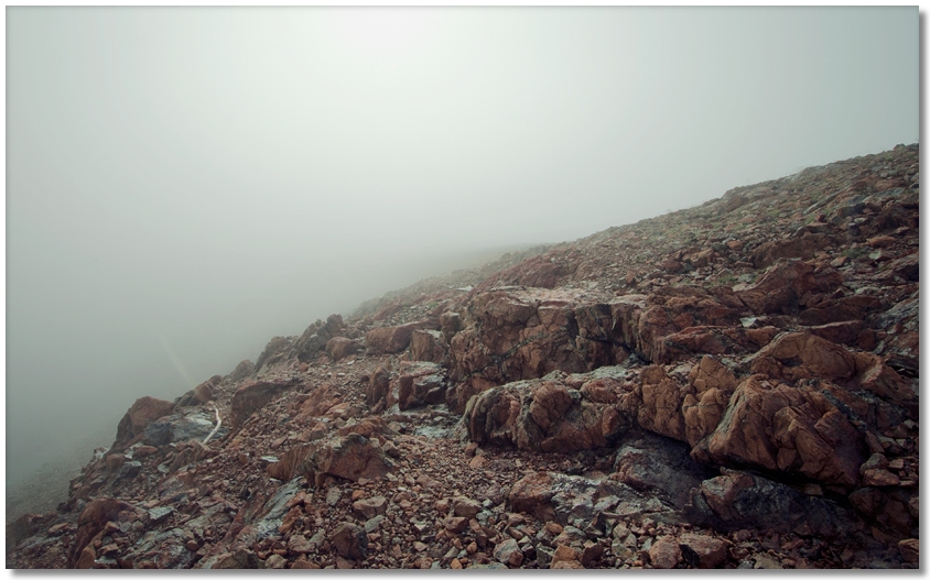
A Saturday trip to Mt. Eddy this time of year usually means meeting dozens of people on the trail, but an early start allowed me to believe that I would only meet them on the way back. However, in the pre-dawn darkness I failed to notice that there was a thick cloud cover over the mountain, and I almost drove past the parking area because of dense fog. After sitting in my car for 15 minutes or so to allow my eyes to adjust to the gloom, I started up the trail. As the fog transformed common shapes like boulders or tree stumps into any number of shaggy demons awaiting my arrival, I began laughing out loud when I remembered a similar situation many years before.
Some friends and I were camping in the Crags when a rather serious thunderstorm developed in the late afternoon. The clouds lowered and lightning strikes were sending rocks tumbling down from Castle Dome. Unable to sleep because of the nearby thunder, I emerged from my tent to watch the lightning show. Hearing a noise coming from the direction of the trail, and thinking it highly unlikely that anyone would be hiking around at this time, I saw a large rounded shape bobbing down the trail coming directly toward me. As the hair on the back of my neck began to rise, I finally made out that it was a camper retreating from above us who made a quick getaway from his campsite and was carrying his dome tent, fully expanded, in front of him. As my panic abated he told me that after one lightning strike so close he could smell it he just pulled up the tent stakes and beat feet down to a lower elevation to set up his tent again. I tried not to let on that I thought it was a huge bear coming after me in the darkness...
Back to Mt. Eddy — after a half hour of hiking in fog and drizzle the clouds lifted up and the rest of the trail was rather pleasant. I skirted the sleeping hordes at the lake and slogged along to the Upper Lake, where I was able to see that, although it might end up being a sunny morning almost anywhere else, the top of Mt. Eddy was in the clouds... and in the wind.
After donning a wind shell (which I was really glad I brought) at the ridge above the Upper Lake, I leaned into the wind and slowly made my way up the switchbacks, where I was passed by two guys who had been camping at the lake the night before. We got to the summit and did the best we could under the circumstances, but the wind forced me to hunker down on the west side where it was calm only a few feet below the ridge, but the "view", such as it was, extended out only 20 feet or so. I occupied my time by puttering around and looking at all of the unusual rocks everywhere, where a few summers ago I found a shell fossil in one.
Naturally, as soon as I hiked back down to the Upper Lake I could look back up and see that the summit was clear, but I continued down anyway, seeing a few hikers but not nearly as many as the number of cars at the parking area would indicate — late sleepers all of them...
mt. eddy ridge
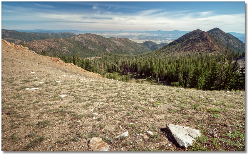
A week later I wanted to try another approach, this time going up the ridge that goes from the Parks Creek Trailhead all the way up to Mt. Eddy itself. This route, as anyone who has done any "ridge hiking" can attest, involves a seemingly unending series of "ups" and "downs". First you go up to a peak, the down to the saddle between it and the next peak, then up to that peak, then down again... over and over. Fortunately, after the first "peak" is reached, the brush thins out and the hiking is fairly easy, allowing you to pick a route that bypasses brush and boulder fields, if not exactly following a straight line. The views get better and better, and by studying a map or GPS you can stop on your way up at the same elevation as the next saddle and contour around the peak instead of going all the way up to the top. After an hour or so I stopped for a break and took the photo below, looking out over the upper end of the Eddy Creek drainage into the Shasta Valley.
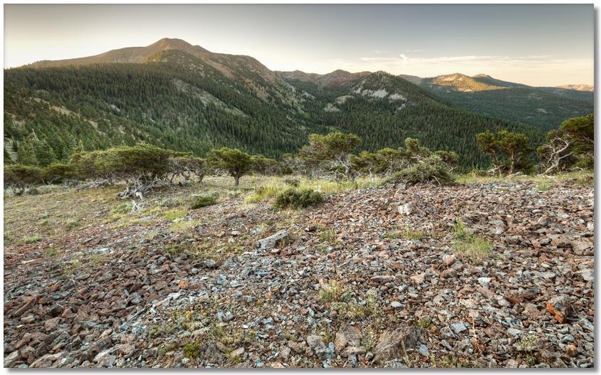
Looking to the south, the peak of Mt. Eddy is hidden by a closer peak (8727T on the map), but the basins of the Deadfall Lakes and Bear Creek can clearly be seen. After this point the ridgeline turns to the south and the large basin of the upper Dale Creek drainage begins on the left. Hiking along here is very pleasant, as there is little underbrush and one can wander freely about, admiring the many examples of Mountain Hemlock.
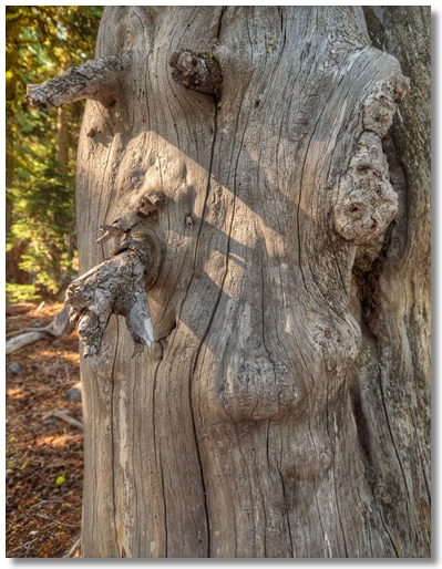
If you follow the tree-covered ridge in the photo above from left to right you'll see a small hill sparsely covered with trees, just before the bare rocky peak in the distance. This is as far as I got, as it seems to be a huge pile of large boulders very similar to Black Butte, and at this point my knees were barking, so I took a break at the base of the tree in the photo below, which resembled a face eating a small branch, and headed back.