Hiking Journal
October 2015
pct/bob's hat trail/service road/kettlebelly trail loop
I wanted to come up with some sort of loop within the Park that didn't involve any epic manzaneering, so I started at the Vista Point parking area and headed out the Pacific Crest Trail. Since it was on a Tuesday I expected to have a pleasant, tourist-free hike, which I did. I turned downhill on the Bob's Hat Trail until I reached the service road, then turned east and headed downhill through the woods until I reached the road again, but shaved off 1½ miles of road walking in the process.
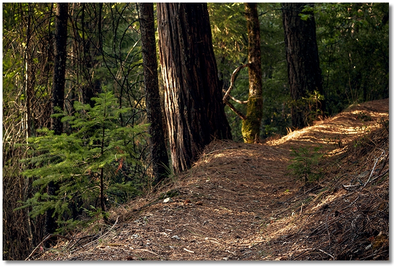
Hiking along this section of the service road is quite pleasant — it narrows a bit, it's mostly shaded, and at this time of year at least, has a lush carpet of pine needles to make it seem more like a wide trail than a dirt road. The downside, if there is one, is that the closer you get to the Vista Point area you experience the din of the omnipresent freeway noise. Tuning this out as best I could, I continued along the ever narrowing Kettlebelly Trail to it's junction with the PCT, then backtracked a ways and hoofed it up the power line corridor to the parking area for a nice 4½ mile tour of the park.
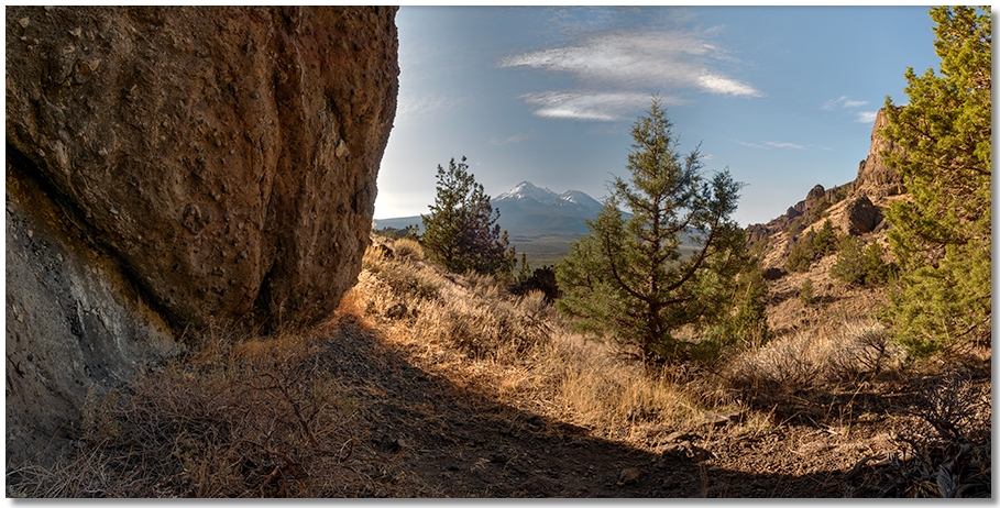
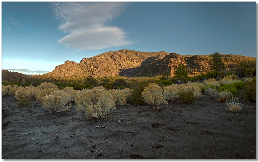
castle dome
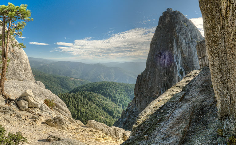
Feeling spry I decided to hike up to Castle Dome, a place I first discovered 40 years ago. It was a beautiful Friday morning, and the only other people at the Vista Point parking area were a group of climbers headed in the same direction. The first sign of Fall around here is not the falling of leaves but the falling of pine needles, which had put down a pretty good cover on the trail and everywhere else. Despite the occasional slipperyness I made good time up to the junction of the short trail over to Indian Springs, then slowed a bit on the upper half before getting up to the back of the Dome in about 1½ hours of moving time.
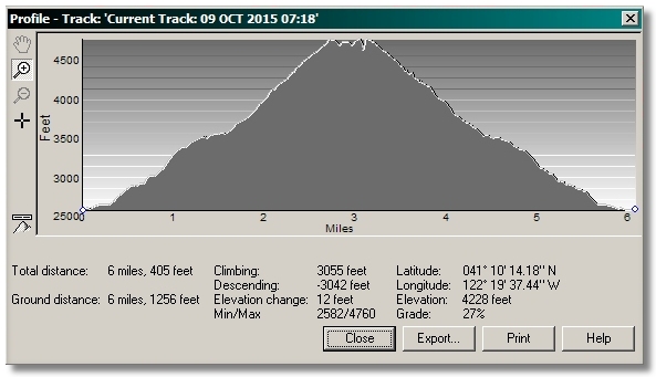
(courtesy of Terrain Navigator software)
This is not a trail I'd want to do every day, but after a short rest I poked around here and there before heading back down, admiring the sole Brewer's Spruce along the way. As expected, there was the caravan of hikers heading up as I was heading down, with a very over-weight and very perspiring woman asking me how far it was to the "rocks". I was torn between advising her to turn around and head back to the car, or cheerfully stating that they're "just around the next bend", which would have been true because there really were rocks around the next bend... and more around the bend after that... and even more around the bend after that bend, since she didn't specify just which rocks she was talking about.
indian creek
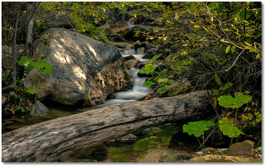
I wanted to see if the Fall "colors" were happening yet so I hiked out the Indian Creek Nature Trail to follow Indian Creek and see how the dogwood, maple, oaks, and aspen were progressing. Although there were plenty of leaves on the ground, it was still a little early for the big show, or what passes for the big show around here.
Working my way upstream I was glad to see that there was still a good flow of water in the creek. The wet fallen leaves and pine needles covering the rounded, already-slippery rocks in the streambed made for some attention-grabbing crossings, even this late in the year. There was sign here and there indicating that the bears hadn't decided to go into hibernation yet, and for some reason the sound of chirping birds followed me the entire way. Returned most of the way using the old flume trail on the uphill side of the creek.
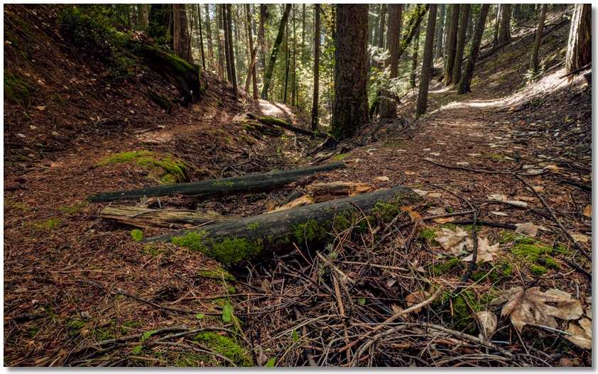
milt kenney's trail
I didn't have the time (or energy) for a grueler, so I took a nice hike in the Park above the campground. Up the shortcut to Bob's Hat Trail brought me to the Service Road, then right and up a ways to the turnoff to Milt Kenney's Trail, then along that trail until it turns and goes down to the paved road, where I cut up and across to the Service Road again, then back along that to my starting point. Nothing earth-shattering occurred, but I had a very pleasant walk on a leaf-covered trail in shady woods, which is just what I was looking for.
sheep rock
I hadn't been over to Sheep Rock in a long time so I headed over just after sunrise, hoping to have a walk on a nice sunny day, but I got there a little too early, and it was still in the 30's in the shade, but warmed up quickly once I got over to the rocks. This is a great place to hike in the Winter because it gets a lot more sun and less snow than my usual haunts. I think of it as sort of a poor man's Utah, where the long descent on the sand-covered emigrant trail was made easier because the sand was damp and firm, not like in the Summer when it feels like walking up a sand dune. The ground, however, being usually firm, was a bit spongy because of a recent rain and the considerable layer of pine needles that were everywhere. I poked around here and there and got in a 4½ mile loop before getting back to the car.