Introduction
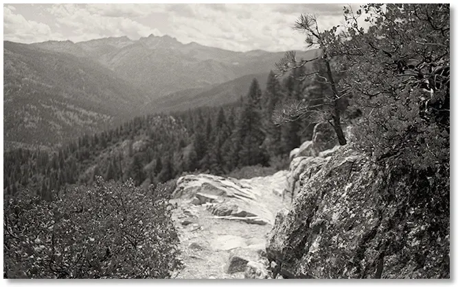
The trail out to Indian Springs [shown above] is one of my favorite places to watch the sunset and either savor the last few moments of warm sunlight on a cold day or the beginning of a cool evening after a hot one. This spot was reached only after a couple of hours of walking from town or a couple of minutes from a camp site that my friends and I set up nearby in the mid 70's as a base to go hiking and climbing.
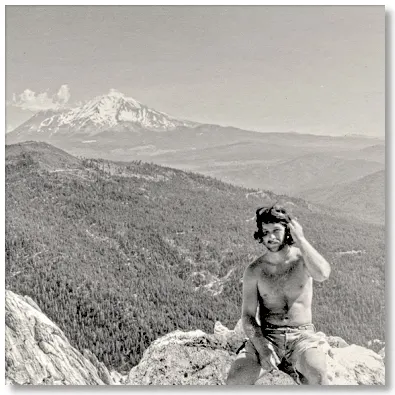
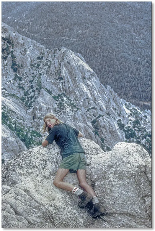
This photo of me [at left] sitting on top of Castle Dome was taken with my faithful Brownie Hawkeye camera in the summer of 1975, with Mt. Bradley and Mt. Shasta in the distance.
This represented the first time that I had actually looked down at the Crags, instead of up at them from the railroad tracks below.
My early trips to Castle Crags State Park were made possible by the Southern Pacific Railroad Company. Not as an employee, but as a non-paying passenger, enjoying the scenery from the doorway of a boxcar [see photo below]. My friends and I would catch out of either Oakland or Roseville on Friday night and de-train in Dunsmuir, then walk back to the park to spend Saturday hiking and rock climbing, returning home by train on Sunday.
To minimize the amount of gear we had to carry back and forth we made a cache near our camp on Root Creek by burying a couple of 5-gallon plastic buckets, adding lids, and covering them up with a few inches of dirt and pine needles. This allowed us to store cookpots, silverware, first-aid stuff, matches, books, and whatever else that we only used at camp and didn't need on the train.
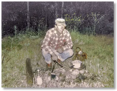
We built another camp below the Crags along the tracks [photo at left] to use if we got in late and didn't want to hike up Root Creek in the dark.
Our arrangement worked flawlessly for several years until we made the mistake of throwing some un-washed dinner dishes into a bucket and hastily adding a minimal covering of dirt over it in order to get back to the freightyard as quickly as possible. When we arrived at camp the next Spring there was a good-sized pit where the buckets used to be, surrounded by zillions of pieces of our chewed-up gear, thanks to a hungry bear.
The trail up to the Dome was a grueler, especially if one was laden down with climbing gear. First we had to walk the 5 miles or so from the freightyard to the park, then it was another 2 miles up to a camping spot at the junction of the Indian Springs trail, then an even steeper mile of 7% up to the saddle behind the Dome. If we wanted to camp at Root Creek and explore the series of waterfalls/pools below the east face of the Dome it cut off a couple of miles of hiking along the railroad tracks but added a mile of bushwhacking up the creek.
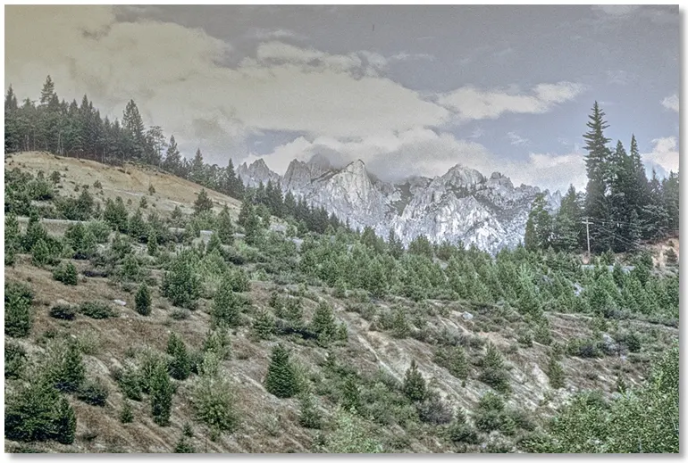
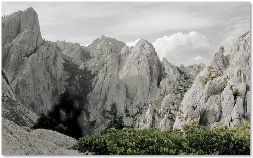
The Root Creek drainage was a narrow east-west valley that stayed fairly cool in the summer, being shaded in part by the Crags, and it had the added benefit of a cold creek running its length, so on hot days it was where we spent a lot of time. On cooler days we'd gravitate to the upper reaches near Castle Dome, which had more sunlight and better views [shown below].
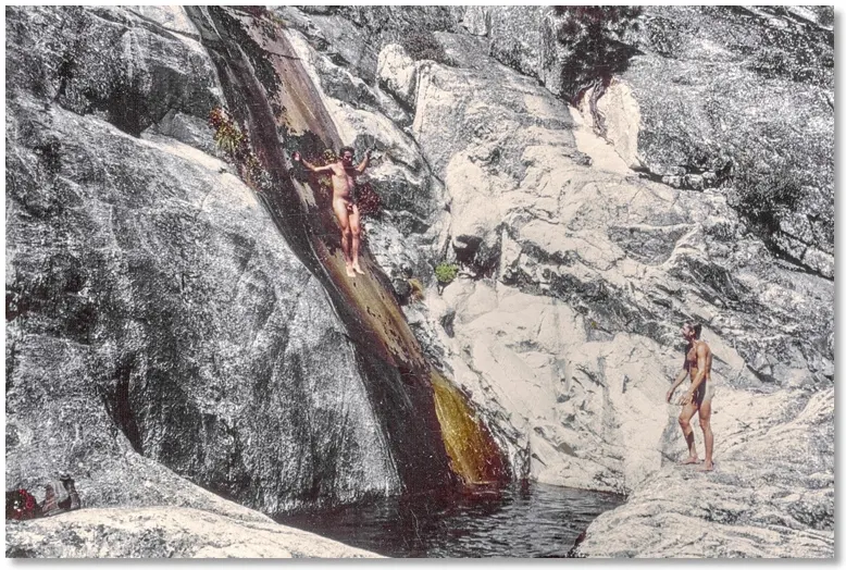
Our main interest, when we weren't climbing or hiking, was hanging out at the pools below the Root Creek waterfalls. The upper pool [shown below] was over 16' deep and you could safely jump in from a rock ledge 20 or more feet above the water. There was another smaller pool below it and another even smaller one below that.
Another activity was scrambling up to the top of Castle Dome [shown below]. On windy days the safest way to look out over the drop off down to Root Creek was to approach the edge on one's stomach. Looking over like this is how we discovered the pools below.
At some point we heard that a section of the Pacific Crest Trail had been extended through the park and to points west, so we began to explore the south side of the Crags, now that the epic manzanita thrash had been replaced with a trail wide enough, it seemed, to allow the passage of a small car. This expanded our climbing and hiking range considerably, and made possible the longest hike that we'd ever done.
Waking up early on a Saturday morning, we headed cross country straight uphill from Root Creek until we reached the Crags Trail, passing (but, unfortunately, not avoiding) numerous patches of poison oak. We then hiked down the trail until it connected with the new PCT trail, and followed that west along the lower part of the Crags, then up the north fork of Castle Creek to the divide, where the trail turned left and we turned right and went cross country down into the Little Castle Creek drainage.
This would normally have been impossible because of the dense, head-high manzanita but thanks to a late Spring snowfall we floated over the tops of the brush for most of the way. Near the canyon bottom things got ugly when we'd break through the thinning snow cover and plunge into a huge manzanita bush and have to spend quite a bit of time to climb back out. One last bare-footed, knee-deep crossing of the roaring creek and an easy descent to the mouth of the canyon on a dirt road. The excitement was over but we still had to walk all the way to the north end of Dunsmuir to wait for a train. It was dark when we made it to the catch-out spot after walking over 20 miles. Ahh, to be in my 20's again...