accessing the PCT
The Pacific Crest Trail can be reached from several points in Castle Crags State Park:
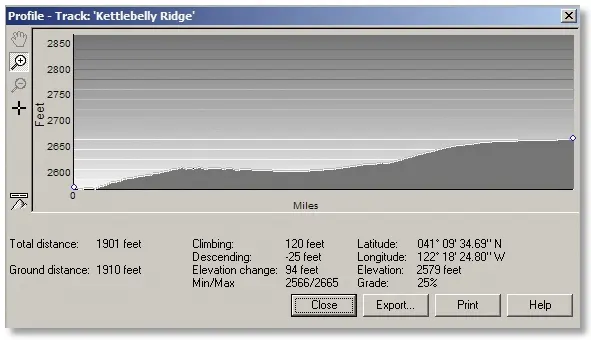
The Crags Trail begins at the Vista Point parking area, reached by a steep, winding, narrow paved road from the Park Headquarters. This trailhead has a bathroom. Hike west along a level trail until a sign directs you to the left for the "Crags Trail". A short uphill section brings you to a powerline right-of-way where you meet the PCT.
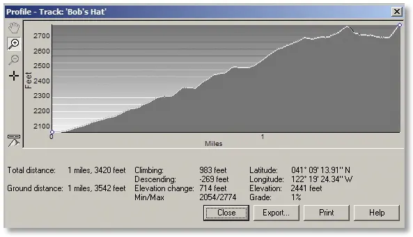
The Bob's Hat Trail begins on the entrance road just past the Headquarters building. Park in the lot to the south (with a bathroom) and hike up the road past a metal gate. Soon the road turns to dirt and twists and turns uphill untill you reach a signpost on the right directing you to the right fork which, yes, continues uphill to another signpost on the left, where you leave the road and follow a trail up to the PCT.
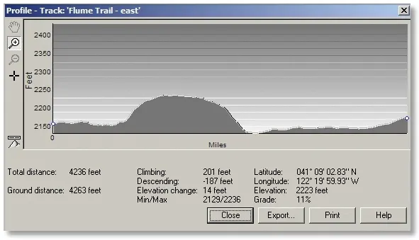
The eastern section of the Flume Trail takes off from the Indian Creek Nature Trail Loop, a few hundred yards "counterclockwise" (south) of the upper bridge. Mostly level except for a "bulge" near the middle, it meets up with the "western section" [my term] at the bathroom near the paved road.
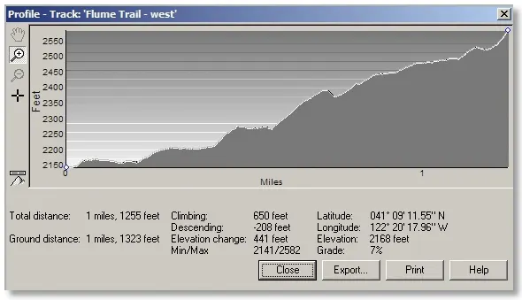
The western section of the Flume Trail starts a short distance past the Park Entrance along the paved Castle Creek Road. Park where you see a small sign for the Environmental Campground on the right. Once you start on the trail there'll be a small bathroom, and the trail contours around the hills toward the west and eventually meets the PCT.
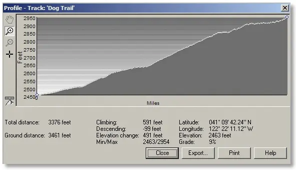
The Dog Trail begins even farther along Castle Creek Road, where you turn off to the right at a tiny sign and park in a large dirt parking area. The trail heads up a steep, sometimes loose route to the PCT.