Disappearing Creek
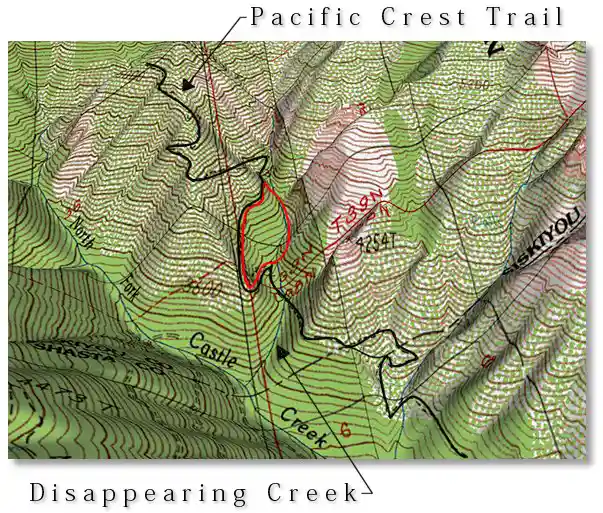
This hike begins on the far western end of the Park, leaving the Pacific Crest Trail and hiking counter-clockwise up the creekbed, then thrashing uphill through old-growth manzanita to reach the trail again, then downhill back to the creek. The raison d'être of including the cross-country section was to eliminate the need to hike back down the creek, but anyone who dislikes pulling yourself up a steep hillside by grabbing at anything you can find and not actually walking on the ground for extended periods because of dense areas of downed branches and trees might choose the return trip along the creek after all.
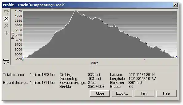
The actual loop is only about 1¼ miles but notice that the last bit of "brushwhacking" before you reach the trail again (the high point) is rather steep, and might involve an inordinate amount of cursing. Upon reaching the trail, however, you will never again be intimidated by having to travel off-trail.
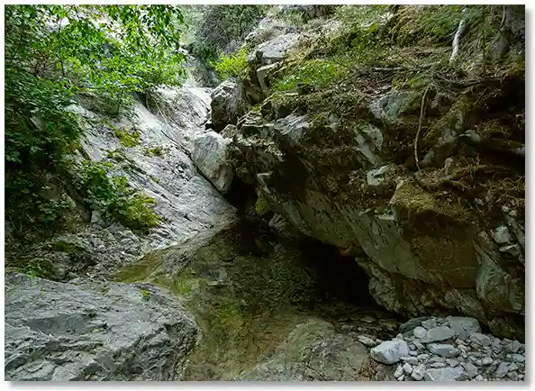
The first view of Disappearing Creek that hikers get from the Pacific Crest Trail might suggest that it floods like crazy during the winter but it's dry the rest of the year. Even on my early season hikes I've never seen much water in the lower section, but it sure looks like at some time during the year there is lots of water flowing through. Obviously one of the easier creek crossings in the Park, the Pacific Crest Trail winds around a bit on the west (trail north) side of the creek until you get to a small, easy to miss sign that says that there's water nearby. I can't remember the exact wording but its meaning is understood providing you see the sign in the first place.
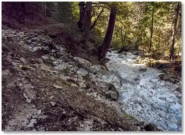
Soon after veering upstream from the PCT you'll see that there is water here — a whole stream full of water, in fact, hence the name Disappearing Creek.
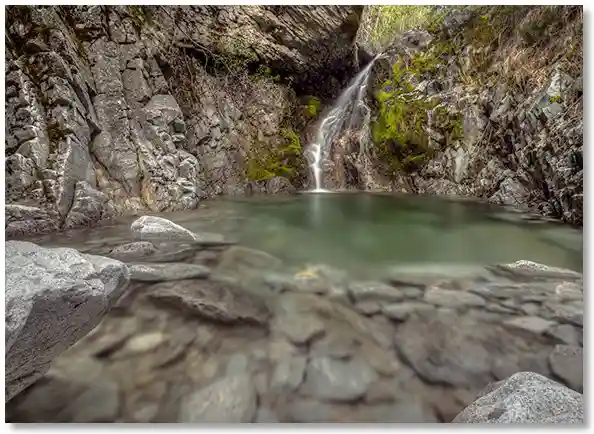
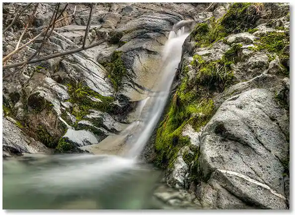
After a bit you come up on my favorite pool, which has to be passed high on the right (or is it the left?). Anyway, you can't just follow the creek anymore.
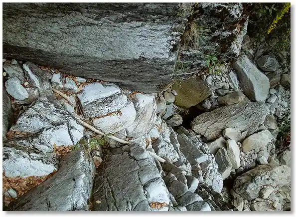
This is looking down on the "trail" along the creekbed that I just hiked up.
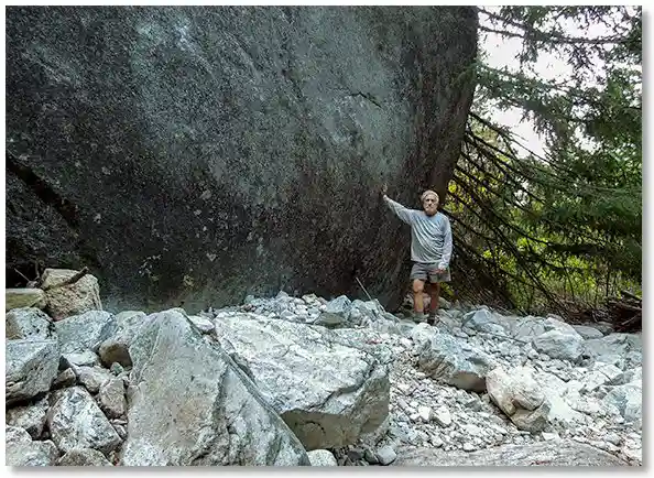
This had to be the biggest boulder I'd ever seen. If it had rolled down a few hundred yards upstream it would have plugged up the entire canyon.
During the drought years the upper section of the creek was passable because the water level was low enough to wade a few steps if necessary, but the opportunities to bypass narrow spots became fewer and fewer. At some point you'll grow tired of scrambling up the creekbed and be faced with the decision to either turn around and return back down the way you came, or head straight uphill to your left, knowing that the PCT is only a few hundred feet away. So near, and yet so far...