Hiking Journal
April 2014
loop trip — root creek, pacific crest, bob's hat, kettlebelly trails
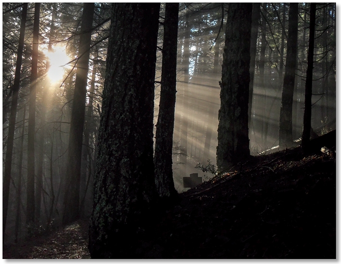
Another several days of crappy weather, then that ONE day of sunshine and I was back to the Crags, this time for an easy leg-stretching hike that didn't involve steep climbs or slippery descents. I started from Vista Point and went out to the Pacific Crest Trail, then followed that to Bob's Hat Trail, and down to the service road.
It was a perfect morning for walking — fog in the canyon bottom, just after a rain, and a canopy of trees to shade the eyes. Weaving in and out of gullys along the south side of the Crags, the faint pink noise of flowing water was replaced by the hum of Interstate 5 as I started to wrap around the east end and head back to Vista Point.
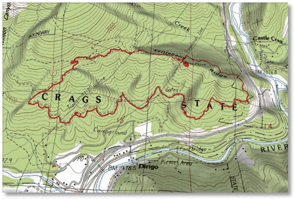
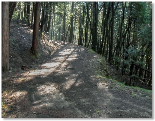
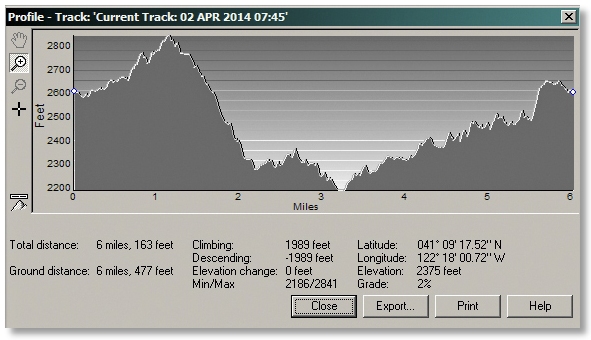
Connecting the four different Park trails gave me an easy hike of a little over 6 miles that took less than 2 hours, but it's probably best done in a counter-clockwise direction, getting the steeper sections out of the way early on.
sulphur creek, pct
The prediction of a week of clear, sunny weather brought me back to the south side, as this area gets pretty warm during the summer and now is the time to enjoy it. Sulphur Creek was flowing loudly and fortunately not much of an "odor" on the way up to the PCT.
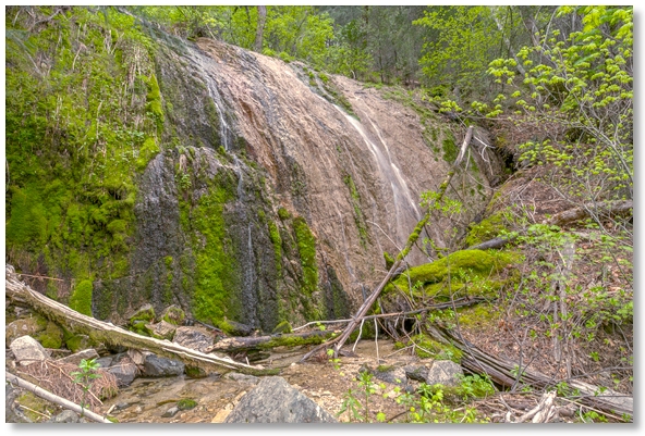
Hiking eastward, Dump Creek was also flowing well, and there was even a dribble coming down Horn Creek. Around the corner I stopped at what I call "Slab Creek" — the creek where the big granite slab is below the trail [not labelled on my map]. A reasonable amount of water today but it's much better during a wet year as the falls covering the slab warms up in the summer and makes sitting in the pool below much more bearable.
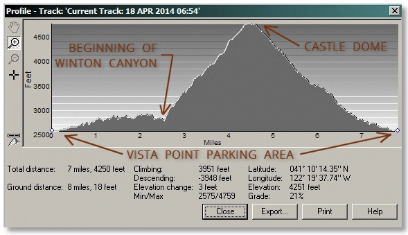
loop trip — pct, winton canyon, castle dome
Another nice day allowed me to continue my explorations along the south side of the Crags. Getting an early start really paid off, as it was 8 hours between leaving the Vista Point parking area and returning to it after an 8 mile loop hike/thrash.
I headed out the PCT for an hour or so to Winton Canyon, where the big wooden bridge spans the creek. I wanted to find a way to get up to the Dome and look for waterfalls along the way. As long as I stayed in the trees, which were mostly oaks throughout the lower section, the climbing was pretty much steep and slippery, thanks to the zillions of acorns carpeting the ground. Sometimes I switched to the bare granite along the creekbed, and other times I had to thread my way through the manzanita jungles, which did the usual number on one's lower legs.
Route finding got a bit dicey while floundering in a sea of head-high brush, but steep, bare ridges of decomposing granite provided convenient escapes. Joining the Crags Trail just below the Dome, I continued up and spent an hour or so up there talking with a friend and watching a procession of young hikers on Spring Break making their way up the trail. On the way back down to the parking area I passed even more, bringing the day's total to over 20 people that I met, but no dogs and fortunately, no kids.
winton canyon
During a period of "un-settled weather" I tried another route up Winton Canyon, this time staying closer to the creek and hoping to get up high enough to traverse west below the rocks and get a look down into Indian Creek canyon, the deepest canyon on the south side of the Crags.
I've tried a few times to start up Indian Creek from the Pacific Crest Trail, but the going is pretty slow, and it's a long way up to anyplace with much of a view. Once you get up to the midpoint of Winton Canyon, however, the brush thins out and there are a couple of decomposed granite ridgetops that, although steep and slippery, offer a reasonable alternative to the manzanita barrens.
Unfortunately, just as I was breaking out above the trees the weather decided to settle into lowering clouds, increasing wind, dropping temperatures, and a very light rain. Oh well, the quest for my overlook of Indian Creek Canyon would have to wait for another day, and I turned east and began to contour over to Indian Springs, where I could follow the Crags Trail back down to Vista Point.
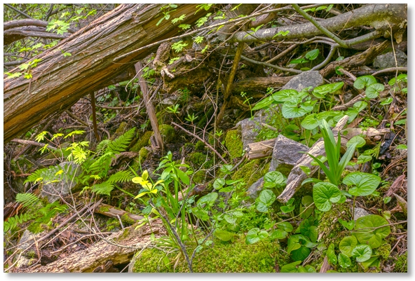
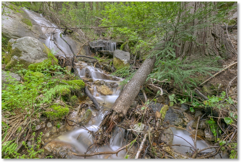
On a topo map, "contouring" looks pretty easy — no going up and no going down, but in this case the various game trails and breaks in the underbrush followed just about every pattern except contouring, so I zigged and zagged my way over to Indian Springs, with the last bit wallowing through a lot of thick, verdant shrubbery, as in the photo above.
In the 5 hours and slightly under 7 miles of hiking/thrashing, the only time I saw anyone else was coming down the Crags Trail when I met 6 hikers in just a 10 minute period.
upper winton canyon
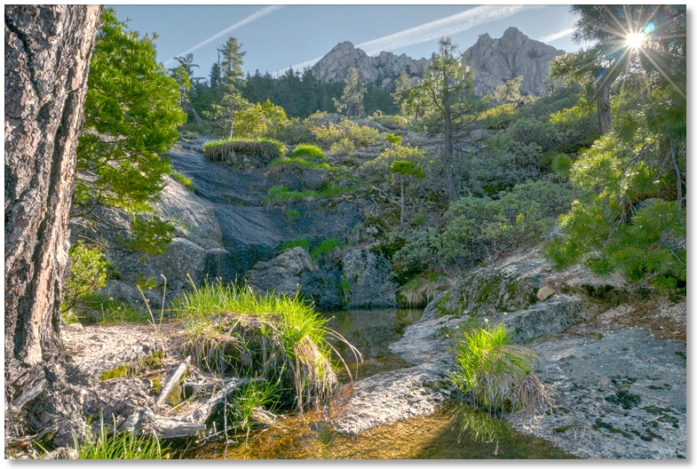
A cloudless day was all I needed to get back to Winton Canyon and explore the upper reaches for a possible traverse from the Crags Trail over to Indian Creek Canyon. After an hour of hiking out the PCT and another hour of thrashing uphill I finally exited the trees and came out on the distinctive decomposed granite ridges that I hoped would allow easier hiking, but it reminded me of being in grade school and dumping a handfull of sand on the slide to make the "ride" faster.
I did spend a pleasant break at the spot pictured above as the sun came up, but the constant climbing on un-stable gravel was more than my knees wanted to deal with, so I exited up to the Crags Trail and followed it back to Vista Point. Just about 7 miles, but it doesn't look like there's a way to cross-country around there without having to deal with the demon manzanita on the way out.