Hiking Journal
January 2014
parks creek
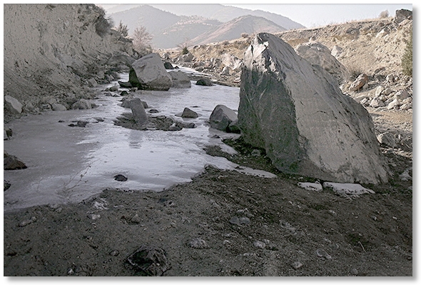
After a very cold and dry Winter I was anxious to get outdoors, even if it was practically in my own "backyard", so I walked over to a branch of Parks Creek that flows into the Shasta River near Edgewood and found it completely dry. Every so often there were patches of foot-thick ice marking the deepest part of pools that were normally flowing quite well at this time of year.
haystack, yellow butte, sheep rock
With the weather finally warming up a bit, I created an excuse to go for a walk and drove out Hwy. 97 to the turnoff for Haystack. One thing that this area had going for it was its location along a flyway for Bald Eagles going from Alaska to who knows where. I watched a very large and impressive eagle glide along the top of Haystack with almost no effort at all. Funny how if a person is remaining motionless they're looked upon as being lazy, while an eagle can float along equally motionless and look majestic...
Fortunately for anyone who wants to hike to the top of Haystack, there is an old dirt road that spirals up from a gate near the highway and eliminates what would be a rather strenuous climb. The views from the top on a clear day can keep anyone occupied for hours. The top of Yellow Butte, more like a hill than an actual butte, can be reached by a dirt road as well.
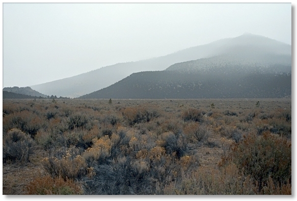
Hiking out here was nice — lots of scenery and close to home. The down side, if there was one, would have to be the lack of variety in plants, trees, and geographic features. Pretty much all sage, juniper, and lava rocks. The brush got to be an impediment, too, as some areas were only accessible by making use of existing game trails, and whatever "game" created them was no where near 6 feet tall. Progress could be made, however, if one was to emulate Groucho Marx and barrel along bent over at the waist. Hiking around Sheep Rock is a bit more serious, but if you try hard you can almost imagine yourself being in sort of a poor man's Utah. There is even a herd of Elk that roam around the flat area below Grass Lake.
north fork of castle creek
I don't get around to this part of the Crags very often because it's a bit of a hike just to get started. Curving around the south side of the State Park, the Pacific Crest Trail turns north and travels along the west side until it almost reaches the ridge above Heart and Castle Lakes, then turns west and heads for the Trinity Divide.
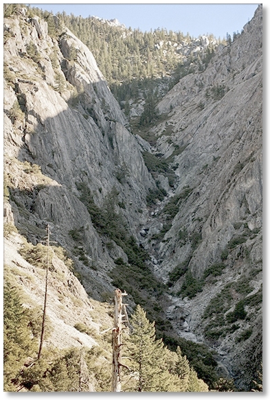
Most day hikers usually turn around at Burstarse Creek, a fact borne out by not only the lack of people I've seen in this area but the marked narrowing of the trail, with brush almost... I don't know... "brushing" against your sides as you walk. Even the geographic features seem to get short changed — the first drainage you come to is on Ugly Creek, which is actually very scenic, even though it appears to be a seasonal "creek" at best. Around the corner is, depending upon who you talk to, either the North Branch of the North Fork of Castle Creek, or the shorter and more descriptive Disappearing Creek.
The PCT enters the Disappearing Creek drainage near the confluence with the North Fork of Castle Creek, then switchbacks up and comes close again at the upper end, before it switchbacks again and goes around the corner and continues up... and up... and up. If you're dayhiking, this is the spot where you begin to think about just how far you want to go, and whether you want to come back down on the State Park side, or go up and over to Heart Lake.
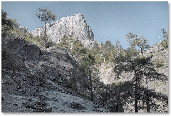
Many years ago I turned right at the saddle and went down the drainage of Little Castle Creek, but it was covered in snow and I had the rare treat of walking over the manzanita instead of through it. Aside from the switchbacks and steepness, the plus side of this section of trail is that you gain elevation in a hurry and with the thinning forest around you there are lots of scenic features to look at, including a side of the Crags that few hikers see. 6 miles round trip.
root creek
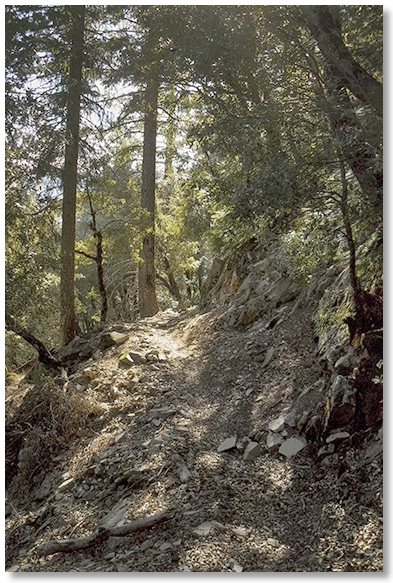
Seizing one of the few mornings that actually showed signs of turning into a nice day, I wandered up the Root Creek drainage until I got to the point where the trail meets the creek. There's still water flowing here, thanks mostly to a spring-fed creek entering from the west just upstream. Continuing along on the climber's trail was almost completely silent, as the creek is now running underground and the freeway noise is far away. Got the photo of the falls above at the un-official "overlook" and returned the way I came. 6 miles round trip.
whitney creek

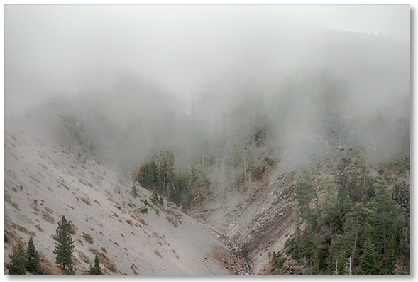
I know, this isn't in Castle Crags, but I just needed a brief change of scenery so I drove out the Bolam Road to check out the trail up to the Whitney Falls overlook. A brief rain the night before kept the dust down but there were low clouds swirling around just above me and rather cold. The "trail" is probably slightly less nondescript than I remembered it from several years ago, with signs of hiker maintenance and what could almost be described as an over-abundance of cairns. This being said, I'll admit to being "off route" a bit at the beginning, but after becoming familiar with the almost continuous cairning the hike went smoothly. Still a bit of a workout but upon arriving at the overlook [below] I couldn't see across the chasm because of the clouds. Cursing the weather, I sat for a few minutes and voilà, they parted and I could see the area of the falls, but no water, just occasional rockfall. Still good exercise at about 4½ miles round trip.