Hiking Journal
September 2014
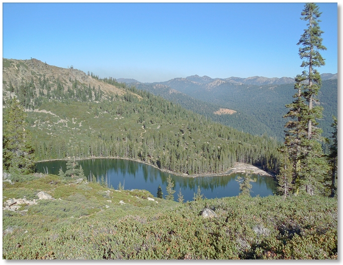
gray rock lakes
With the Labor Day crowds and smoke from forest fires drifting away, I headed up to the Gray Rock Lakes to stretch my legs. After bouncing up the switchbacks to the parking area I was reminded for the umpteenth time that "I should really get new shocks on my truck". This was the first time that I went up beyond the first lake and I soon learned the reason why. Whenever one is headed for anything with a name like the "upper" whatever lake it should immediately raise a red flag reminding you that there is almost always a steep trail involved, and this was no exception.
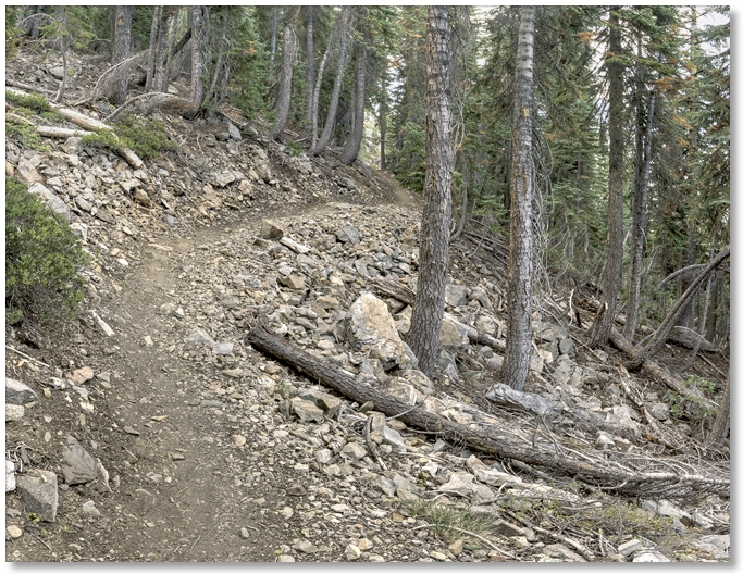
The trail, though steep and rather faint in some areas, was pretty difficult to lose because of the dense, knee-high brush on either side. And, it was refreshingly free of cairns, even with the preponderance of rocks everywhere. Certainly not in the same league with, say, the trail up to the Whitney Falls overlook, where one could almost hop along from cairn to cairn without even touching the ground.
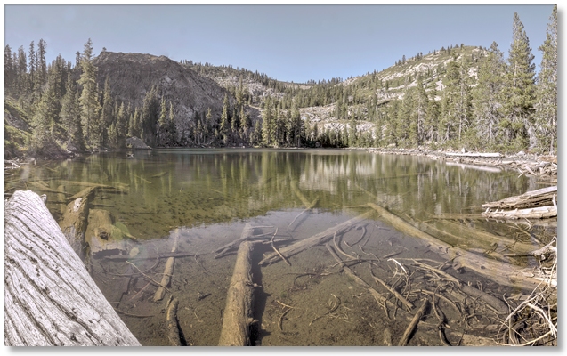
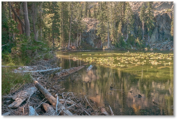
The upper lake was calm and quiet as a tomb, even with an annoying north wind from time to time. I was tempted to stretch out on the log on the left in the photo above and take a nap but was discouraged by some large, persistent black ants. Leaving the lake to the wind and the ants, I hiked back down the trail and angled over to Timber Lake. Most of the water lilies were past their prime but there was still a good amount of water at the southeast end, although a few feet below the usual summer level.
devil's gulch
While this might not rate a "must see" on many people's lists of destination spots, it is a surprisingly wild area despite it's logging history. I followed an old logging road for a few miles to its end, then backtracked here and there into the dense understory, which is similar to the Soapstone Gulch drainage just east of here.
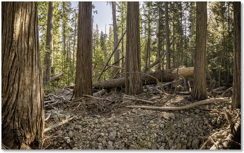
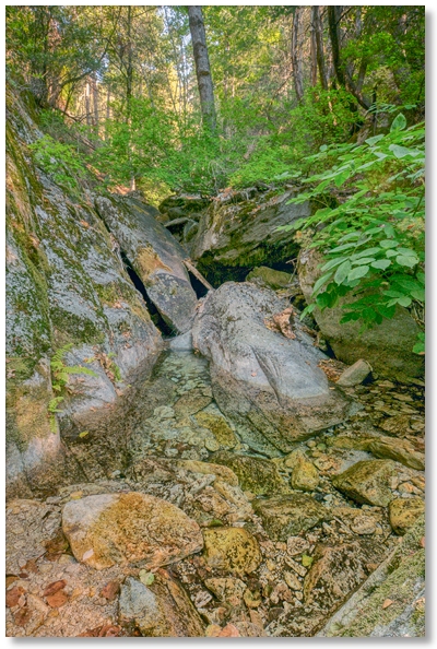
Off-road travel here is not something that I see becoming popular at any time, unless you're the size of a rodent, or look forward to a lot of zigging and zagging. The seasonal creek I followed for a short distance [shown above] was one of the more open areas I traveled through, meaning that I could actually take several steps at a time in the same general direction. The area does have a lot going for it if you just take your time [not a problem] and look at features that might otherwise be missed if one was hiking along at a normal pace. Lots of interesting rocks to pick up and examine, an impressive collection of downed timber in all conceivable sizes, and almost absolute silence leave little else to be desired.
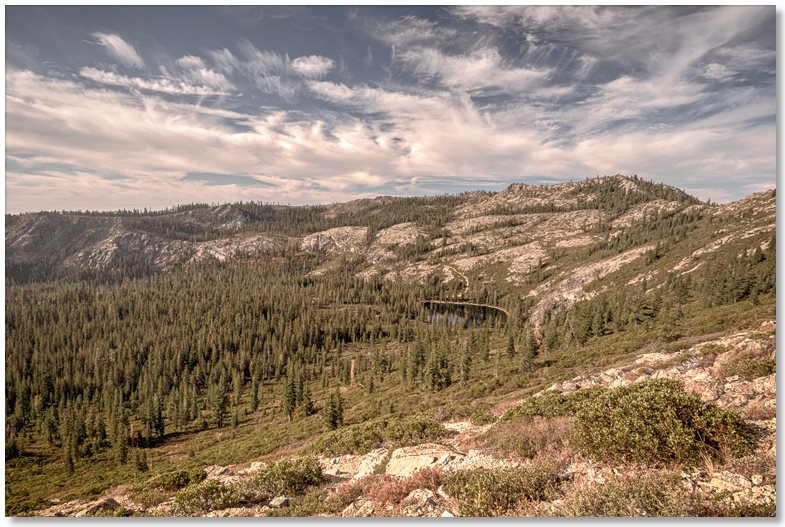
trinity divide
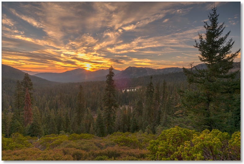
This time of year is good for higher elevation hikes that couldn't be done earlier in the year because of snow, so I headed up to the PCT trailhead above Gumboot Lake for a hike out to the Trinity Divide. Not too long after the sun came up it was pleasantly warm at 6,500', and by the time I reached the Divide an hour later it was just about t-shirt weather.
This is my favorite time of day to travel around — it's cool, quiet, you don't meet many other hikers, and there are still some animals wandering around. On the drive up I watched a bear cross the road in front of me and saunter up a steep embankment with no more effort than he showed on level ground, without making a sound except for the noise of tumbling rocks that he dislodged here and there. I doubt that I could have climbed the embankment no matter how much noise I was allowed to make.
Shortly after passing through the dense grove of trees shown above I watched a golden eagle circling around their tops. Back at the trailhead as I got out of my car I was startled by two deer that were just wandering around, as if I didn't exist at all. Sort of a changing of the guards, with the animal's shift coming to an end and the human's just beginning.
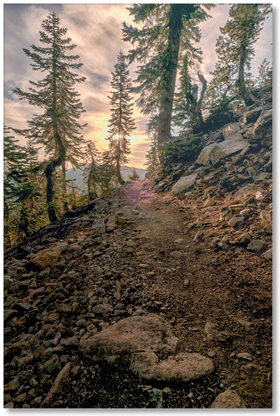
Dropping over to the east side of the Divide was sunny and just a little breezy. This section of the trail has an amazing assortment (and quantity) of rocks, making it important to watch your step, but at the same time giving you an opportunity to see some cool specimens of quartz here and there, with the added benefit of lessening the chances of surprising a snake in the process.
On the way back I passed a man and a woman heading out to the Divide — the only people I saw in over 5 hours and almost 9 miles of wandering around, and noticed the first signs of Fall on the tree in the photo above.
root creek
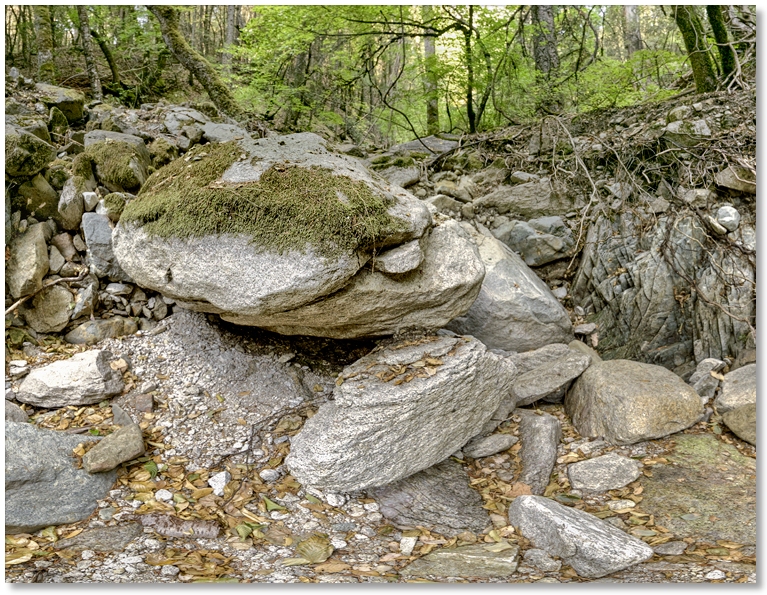
With access to some local areas closed due to high fire danger, I took a walk out to Root Creek to see what the water situation looked like at the tail end of a hot, dry summer. The photo above is looking up the creekbed, not toward the bank — even the moss has dried out. The feeder springs were still flowing, keeping water in the creek above ground most of the way down the canyon. On the way back I got to watch a bear amble along a gully below the Root Creek trail near the junction with the PCT, assuming that to "amble" means he was walking slowly, turning his head from side to side every now and then. He [or she] even made a few "bear sounds", which, if I was pressed to describe them, might have sounded like someone yawning very loudly in the shower...
indian creek canyon
With the chances of getting surprised by a rainstorm in the canyon hovering around zero I headed out the PCT to Indian Creek canyon for another attempt to explore the upper reaches of a very extensive drainage system feeding Castle Creek and the Sacramento River.
Subtle hints of Fall were all around — greenery that wasn't as "green" as it was the last time I passed by, leaves getting a splash of yellow here and there, and the water in pools along the creek was darker and fringed with fallen leaves. My favorite pool [shown below], still looked inviting as always, though.
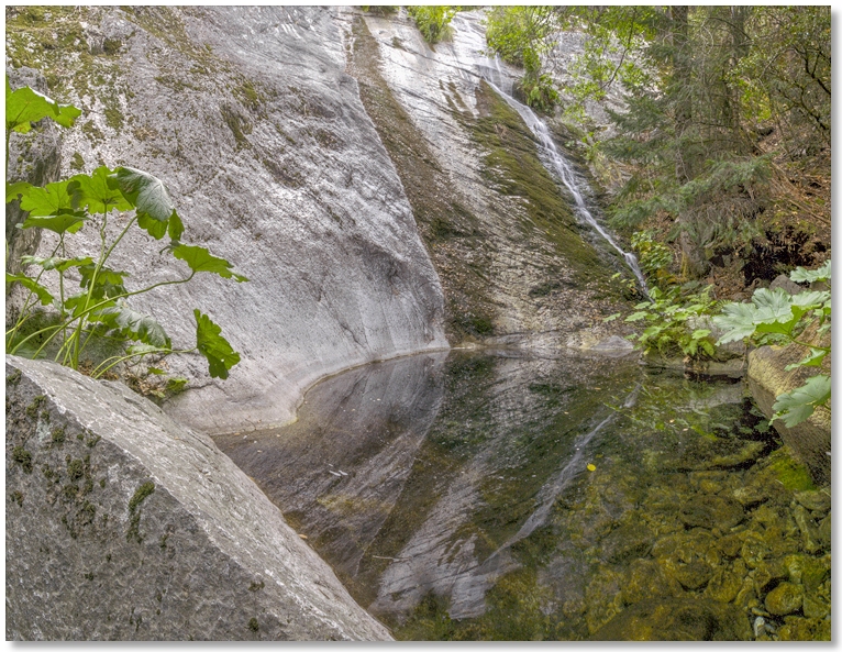
I continued up the canyon until it narrowed down sufficiently enough to eliminate bypassing the creekbed entirely and began the boulder-hopping regimen that I dread when the rocks are wet, but these weren't and I made pretty good progress for several hundred yards farther than my last attempt.
Reminding myself that I should remember to bring some wading sandals next time, my pace slowed to a crawl [sometimes literally] as every effort was made not to plunge into the water while clamboring over the mini-waterfalls that appeared every few yards, but after surmounting dozens of obstacles like in the photo below, I called it quits and saved what lies beyond for another trip.
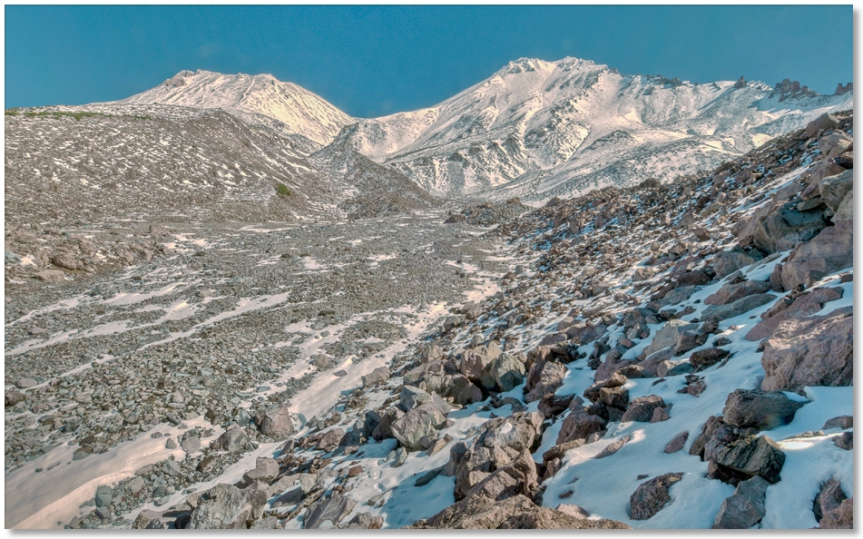
horse camp
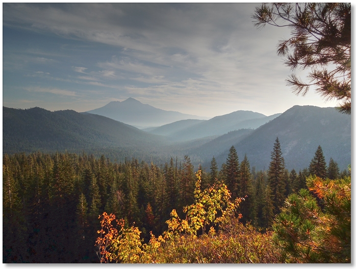
With the first snow of the season reaching down almost to the treeline on Mt. Shasta, I figured that I should get in as many high altitude hikes while I still can, and headed up to Horse Camp to try for Hidden Valley. Even shortly after sunrise at the parking area at Bunny Flat there were a few people traveling to the beat of a non-existent drummer, and possibly searching for the Hidden Truth in some small pebbles scattered here and there.
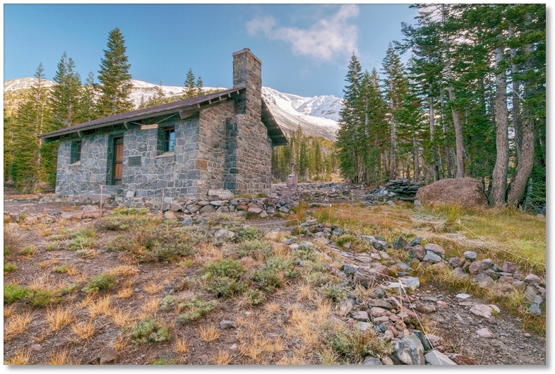
Leaving the Nirvana-seekers behind, I started up the newly re-aligned trail [due to erosion control]. The hike was pleasant but a tad chilly, and soon after I reached the Hut [pictured below] the clouds moved in and rendered everything first a muted black & white, and then a downright dark gray, with everything farther than a few hundred yards away lost in the fog. Not looking forward to another 3 mile round trip to find Hidden Valley truly hidden in the clouds, I turned back and hoped for a sunny, cloudless day in the near future to try again.
hidden valley
With the aforementioned "sunny, cloudless day" appearing soon after, I headed up to Horse Camp again for a try at Hidden Valley. Negotiating the warren of cleverly-marked trails that radiate away from the Sierra Club Hut, the trail was easy to follow and soon began the "in-and-out" routine common to trails that contour along the side of mountains. The views were as expected and pleasantly lacking in smoke and haze for once.
If anyone gets bored with trails that seem to go on and on in a perfectly straight line, then this is the trail for you! The phrase "zig zagged" could certainly be used to describe short sections of the final approach to Hidden Valley. Buffeted by a suddenly appearing wind, the entrance to the "valley" [shown below] lies just above a narrow notch in Cascade Gulch, and is reminiscent of the feeling one gets emerging from the Wawona Tunnel and seeing Yosemite Valley for the first time.