Hiking Journal
May 2015
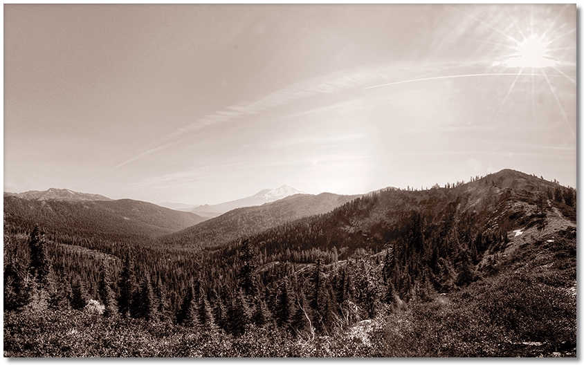
devil's garden
A couple times each year I convince myself that the hiking really isn't that bad in the Devil's Garden area, and after each attempt I remind myself that yes, it is pretty rough going, and this time was no exception. I suppose that if I were a deer, the zillions of downed trees to step over might not be a problem, nor the knee-high tangle of thick brush, but for me, I've never been able to cover much off-road travel without getting scratched up or nearly lost in the forest clutter.
Having a GPS is a great help, as the tree cover often prevents locating distant landmarks (like neighboring peaks), the brush is too high to see any cairns you might leave, and using trees for landmarks doesn't always work, as Ronald Reagan so eloquently pointed out years ago. It's a fascinating area to hike around if speed and distance covered aren't your criteria for a "good time".
trinity divide
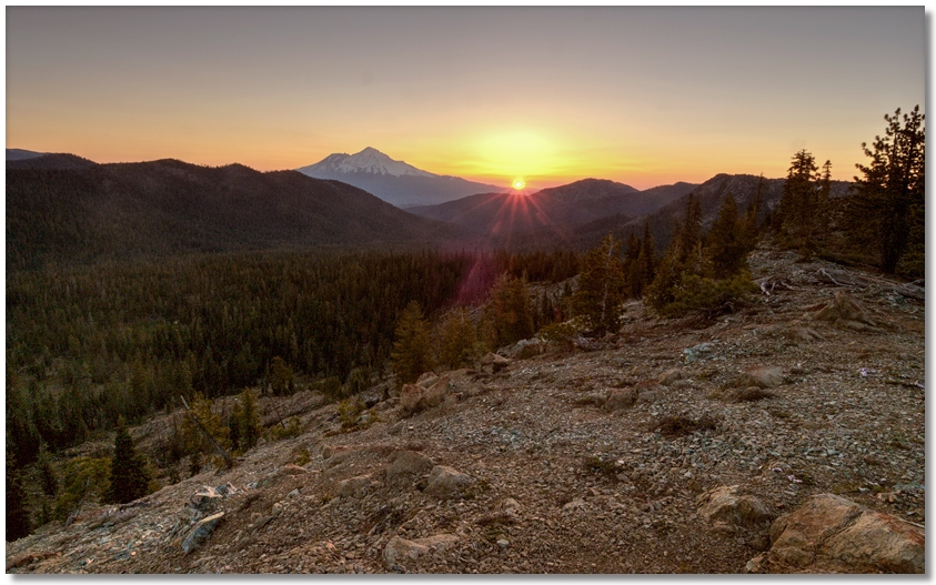
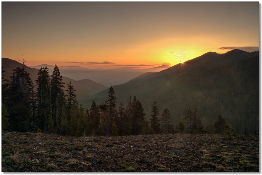
With the snow cover (such as it was) now gone along the crests, it was time to try out higher-altitude trails again. This being the first time this year I'd be heading farther up the canyons to begin hiking, I over-compensated in determining just how early I should leave, and arrived at the trailhead before it was even light enough to start hiking. Pacing around the parking area to get my eyes used to the pre-dawn gloom, I headed out the trail almost by feel alone. Thinking that if there ever was a good time to get a sunrise photo it would be today, I walked up to a high point above Gumboot Lake and got the photo above, while shivering in the just-above-freezing air at 6700' wearing shorts at 6:00 am.
Hurrying along the PCT to warm up, I crossed over the Trinity Divide and plunged into the world of sunshine and warmth. After shedding some layers, I had a pleasant hike east along the PCT until I got to the junction of the trail that heads down to "water in 1/3 mile", where I stopped to check out the upper end of the Devil's Garden area with binoculars for possible hiking routes that didn't involve floundering through the thick ground cover, but didn't find any. Oh well, in a few months when my scratched-up legs have healed I'll give it another try...
sisson-callahan trail
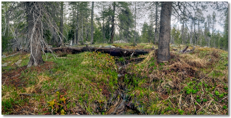
With the Deadfall Basin still under snow cover I planned to hike up to the divide along the east end of the Sisson-Callahan Trail, which uses the drainage just south of the Deadfall Lakes drainage. It was a "marginal" weather day, which meant I wasn't really sure if it was going to rain or not, but since it wasn't raining now, I headed up the logging road that eventually turned into a trail.
It shortly became evident that the bears were officially out of hibernation when I counted a half dozen piles of scat [who makes these names up?] in the first quarter mile or so. The clouds were now lowering rapidly when I walked out into a meadow to poke around and within minutes they were almost at ground level with a light snow falling, so I turned around and headed back.
deadfall lakes
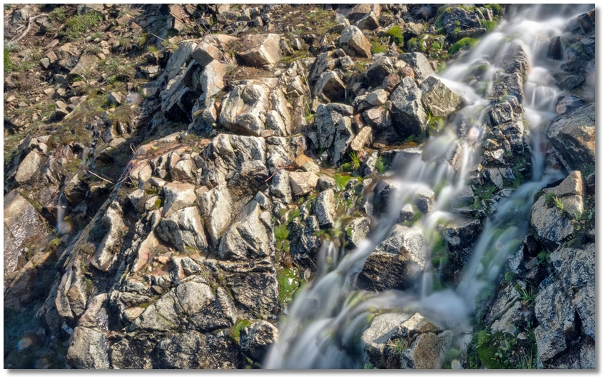
On Memorial Day I wanted to go for a hike but, fearing the hordes of "holiday weekend tourists" invading the woods with screaming kids and barking dogs, I got a very early start and was able to enjoy the sunrise from a hill just north of the parking area at the Deadfall Lakes trailhead. On the way to the lakes I noticed that the previous two weeks of on and off rain had done a good job melting what snowpack was left up above and just about every place that could serve as a conduit for meltwater was.
Lots of side-stepping wet areas on the way to the lakes, and the outlet to the upper lakes was as high as I've ever seen it. Snow cover above the upper lake kept me from hiking further due to my less-than-factory-fresh knees, so I turned around and called it an 8-mile tuneup hike for next time.